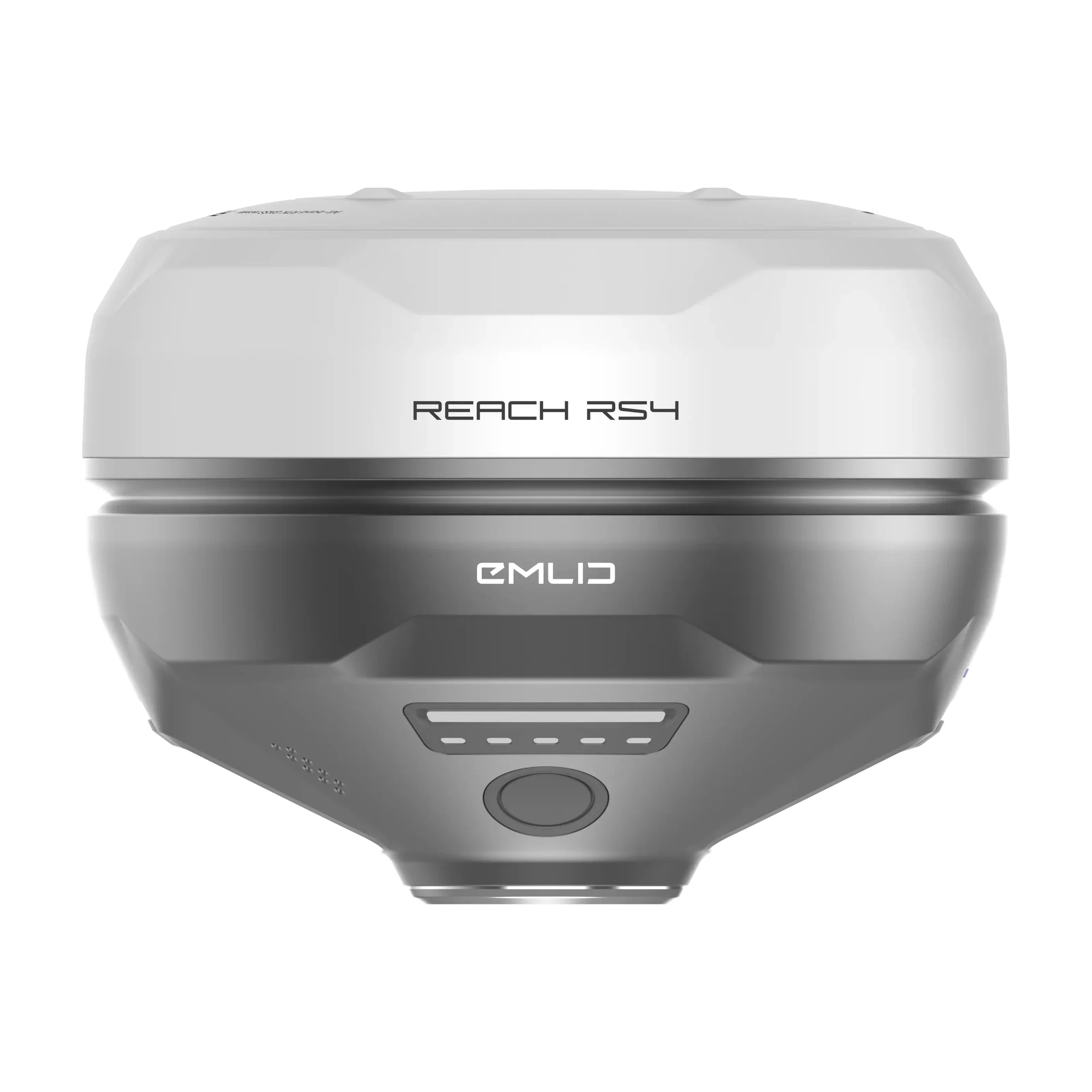
Emlid Reach RS4
Brand: Emlid
Includes VAT · pay in 3 from £1,199.67 with Klarna
- Survey-Grade Accuracy
- Advanced Tilt Compensation
- Flexible RTK Connectivity
- Built for the Field
Order within 17 hrs 13 mins for delivery by Wednesday, 29th July (UK Mainland)
Free collection from our Chichester Experience Centre
Included with the Emlid Reach RS4
Over £180.00 worth of extras included!
-
 RTK Network Subscription Unlimited 30 Days
RRP £180.00
RTK Network Subscription Unlimited 30 Days
RRP £180.00

Pay Safely & Securely With
VIP Membership
Join the club & save £££ - Thousands saved over the years!
Emlid Reach RS4 - Survey-Grade RTK GNSS Receiver
The Emlid Reach RS4 is Emlid’s flagship all-band RTK GNSS receiver, delivering true survey-grade centimetre accuracy even in the most challenging environments. Designed for professionals who demand reliability, speed, and precision, the RS4 combines next-generation IMU tilt compensation, full multi-constellation GNSS tracking, rugged construction, and seamless field-to-cloud workflows.
Whether you’re surveying under canopy, working on construction sites, mapping terrain, or supporting drone operations, the Reach RS4 is built to perform.
Survey-Grade Accuracy - Even Under Canopy
The Reach RS4 tracks all major satellite constellations and frequencies, including the more interference-resistant L5 and L6 bands. With 672 tracking channels and the ability to track 40+ satellites simultaneously, it maintains stable RTK fixes in environments where other receivers struggle.
This results in reliable centimetre-level accuracy, even near buildings, trees, or reflective surfaces.
Next-Generation IMU Tilt Compensation
Work faster without sacrificing accuracy.
The RS4’s advanced IMU tilt compensation allows precise measurements without keeping the pole perfectly vertical. Even at a 30° tilt, the RS4 achieves up to 18 mm precision, dramatically improving efficiency in tight or obstructed areas.
Activates with just a few movements
No frequent recalibration required
Stable and reliable throughout the survey
Perfect for kerbs, boundaries, walls, and hard-to-reach points.
Precision Quick-Release Mount
Tilt compensation is only as accurate as the connection to the pole.
The RS4’s purpose-built quick-release mount eliminates backlash and movement between the receiver and pole, ensuring maximum accuracy when tilted. It provides a secure, repeatable fit while allowing fast attachment and removal in the field.
Flexible RTK: Base, Rover & NTRIP
The Reach RS4 adapts to your workflow:
NTRIP RTK
Works with VRS or single-baseline CORS networks
Supports RTCM3 format
Can act as or connect to an NTRIP base via Emlid NTRIP Caster
Dual-Band Radios (Built-In)
UHF 450 MHz
Transmit & receive
Up to 2W output (licence may be required)
Compatible with Reach and select third-party receivers supporting TRIMTALK 450S
LoRa 915 MHz
Transmit & receive
Up to 1W output (licence-free in North America)
Optimised for Reach receivers
Built for Harsh Environments
Magnesium Alloy Body
The RS4 features a lightweight magnesium alloy chassis, commonly used in aerospace and high-end electronics. It offers exceptional durability without unnecessary weight - ideal for demanding field use.
All-Day Power
Up to 16 hours of operation on a single charge
USB-C charging
Can be powered from a power bank for extended sessions
IP68 Waterproof & Dustproof
Fully sealed against dust, rain, snow, and construction site conditions.
Extreme Temperature Rated
Operates reliably from -40°C to +65°C, making it suitable for year-round use in the UK and beyond.
Emlid Flow - Field to Cloud Software
The Reach RS4 is powered by Emlid Flow, a modern mobile and cloud ecosystem available on iOS and Android.
Easy field setup and control
Real-time RTK status monitoring
Cloud project sync and team collaboration
Seamless data export to industry-standard formats
Designed to keep projects organised, teams aligned, and workflows efficient.
Ideal For
Land surveying
Construction & civil engineering
Mapping & GIS
Drone surveying & ground control points (GCPs)
Utilities, infrastructure & environmental work
What our customers say - 1,721+ Google reviews
"Perfect in all areas, Staff spend time to explain something in detail in plain speak that enables you to make an informed choice. The Drone was spot on for my son. A win..."
"Great shopping experience with these guys, ordered Sunday, delivered Tuesday. . . With a better deal than the DJI website, £80 off, with a free 128gb SD card & RC2 scree..."
"bought a few items from Drone Safe Store of high value (matrice 4e, various accessories additional batteries, manifold 4 and payload development kit) always arrives promp..."
Accreditation
 Armed Forces Covenant
Proudly supporting the Armed Forces community and veterans.
Armed Forces Covenant
Proudly supporting the Armed Forces community and veterans.
 ISO 9001 Certified
Certified quality management systems for consistent service and customer satisfaction.
ISO 9001 Certified
Certified quality management systems for consistent service and customer satisfaction.
 DJI Enterprise A Rank Retailer
DJI's highest level of authorised retail and technical expertise.
DJI Enterprise A Rank Retailer
DJI's highest level of authorised retail and technical expertise.
 D-U-N-S® Registered
Globally recognised business identity, verified for international trade. Number: 221162020
D-U-N-S® Registered
Globally recognised business identity, verified for international trade. Number: 221162020
 Financial Conduct Authority
Authorised and regulated by the FCA for consumer finance activities.
Financial Conduct Authority
Authorised and regulated by the FCA for consumer finance activities.
 YPO Approved Supplier
Approved on the YPO framework as a supplier for Drones & Associated Services to help the Public Sector
YPO Approved Supplier
Approved on the YPO framework as a supplier for Drones & Associated Services to help the Public Sector